SK Pohjantähti logo

Pasi Ikosen rastit 2026 ja Barents Games suunnistus

Kaksipäiväiset kansalliset Pasi Ikosen -rastit ja Barents Games -suunnistus Kiimingin Soidinharjulla 22.–23.8.2026

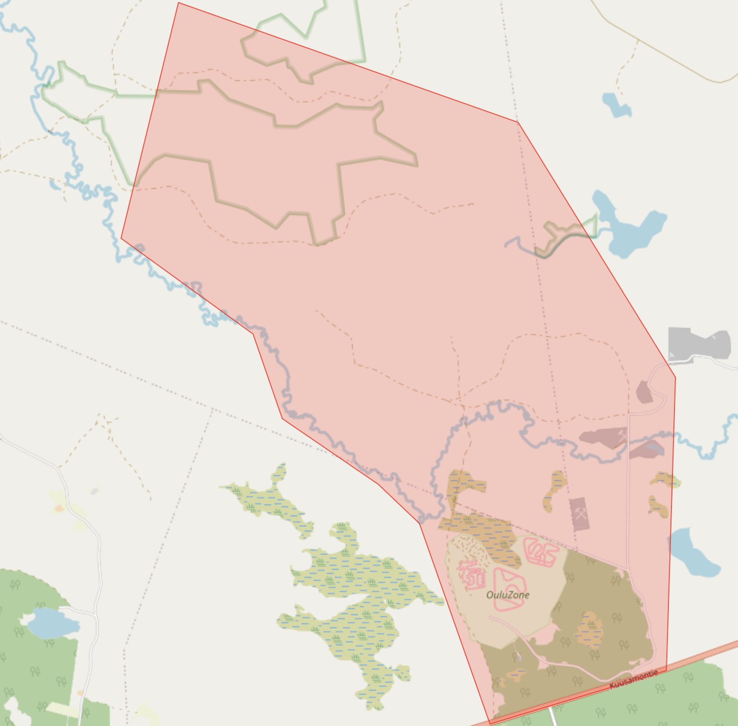
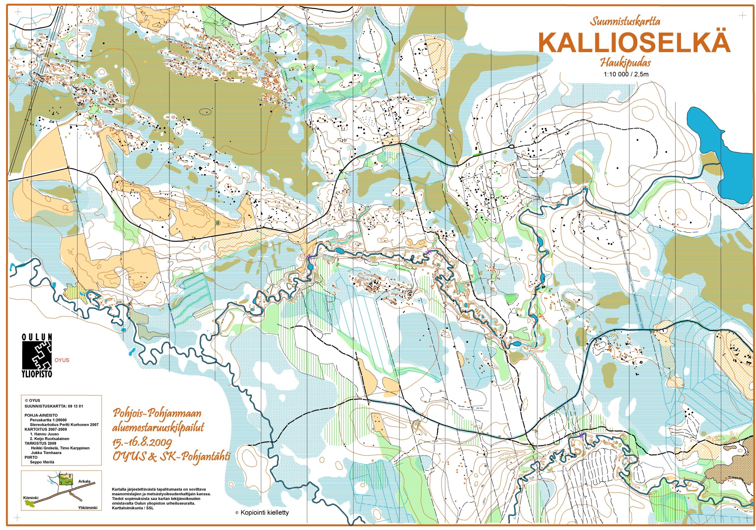
Tarjolla on laajalti uusi alue suunnistajille ammattilaisten tekemällä kartalla. Maasto on meanderoivien jokiuomien ja jokien lampimuodostelmien rikkomaa monipuolista metsä- ja suotyyppiä. Osa ilmoittautumismaksuista ohjataan Suunnistussäätiön Pasi Ikosen -rahastoon.

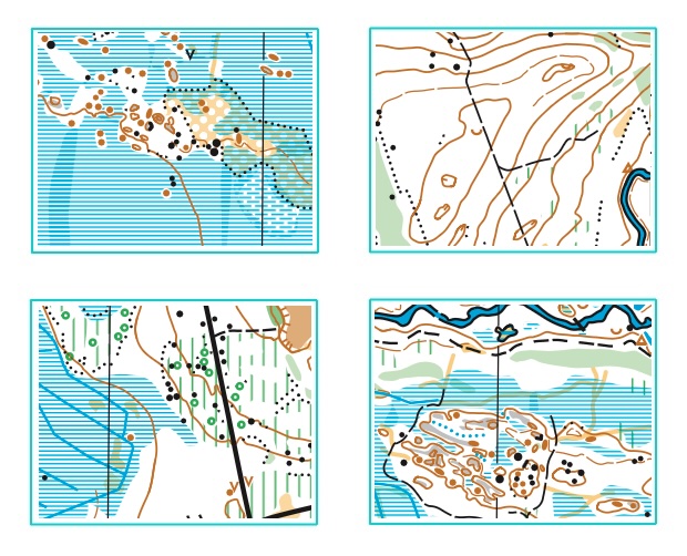
Pasi Ikosen rastit 2026 Barents Games karttapaloja

Kilpailuohjeet – Bulletin

Julkaistaan lähempänä ajankohtaa.

  • Lähtöön 1 matkaa lauantaina 1,2km ja sunnuntaina 200m
  • Lähtö 2 on kilpailukeskuksessa
  • Rastimääritteet on kartassa
  • Kilpailukeskuksen kartta Barents_Games_kisakeskuskartta

Bulletin will be published closer to the event.

  • Distance to Start 1: 1.2 km on Saturday and 200 m on Sunday
  • Start 2 is located at the competition centre
  • Control descriptions are printed on the map
  • Map of the competition centre Barents_Games_kisakeskuskartta

Lähtöajat – Start lists

Lauantai 22.8. – Saturday

Sunnuntai 23.8. – Sunday 

Tulokset – Results

Lauantain live-tulosseuranta – Sat live results
Lauantain tulokset – Sat results /  Väliajat – Sat split times

Sunnuntain live-tulosseuranta – Sun live results
Sunnuntain tulokset – Sun results / Väliajat – Sun split times

Yhteistulokset – Total results

Livelox

Sarjat ja matkat – Classes and distances

Lauantai / SaturdayPituus / Length kmRastit / ControlsMittakaava / ScaleLähtöpaikka / Start
H2110,42231:100001
D21, H20, H357,27171:100001
H18, H40, H456,48151:100001
D18, D20, D35, H50, H555,57131:100001
H16, D40, D45, H60, H653,72111:75001
D16, D50, D55, H703,198 1:75001
D60, D65, H75, H802,828 1:75001
H14, D14, D70, D752,828 1:75001
H12, D12, D80, D851,25 1:75002
H12TR, D12TR1,251:75002
H10RR, D10RR, H8RR, D8RR1,68/1,0851:75002
Sunnuntai / SundayPituus / Length kmRastit / ControlsMittakaava kaikilla 1:7500 / Scale for all 1:7500Lähtöpaikka / Start
H215,1216 1
D21, H20, H354,1616 1
H18, H40, H453,3113 1
D18, D20, D35, H50, H552,8713 1
H16, D40, D45, H60, H652,611 1
D16, D50, D55, H702,3810 1
D60, D65, H75, H801,99 1
H14, D14, D70, D751,9410 1
H12, D12, D80, D85 1,3 6 2
H12TR, D12TR 1,2 5 2
H10RR, D10RR, H8RR, D8RR 1,85/0,94 5 2

Ratamestarin lausunto / Course setter statement

Radat ovat ohjeaikojen alareunoilla. Molempina päivinä on oma alue. Purot voi ylittää lähes joka paikasta, veden syvyys on noin 50cm. Polkusillat kartalla ovat kaatuneita puita josta voi ehkä päästä yli. Sillat on merkattu ko. merkillä. Puron reunaviiva on katkaistu sellaisilta kohdilta jossa reunavalli on matala. Suon ja soistuvan reunat ovat häilyviä. Lasten radat kiertelevät kilpailukeskuksen lähimaastossa ilman purojen ylityksiä.

The courses are at the lower end of the expected winning-time ranges. Each day uses a separate competition area. The streams can be crossed almost anywhere; the water depth is approximately 50 cm. The footbridges shown on the map are fallen trees that may provide a possible crossing. Actual bridges are marked with the appropriate bridge symbol. The stream bank line has been broken at locations where the bank is low and easy to cross. The boundaries of marshes and marshy areas are indistinct. The children’s courses stay close to the competition centre and do not involve any stream crossings.


Valvojan lausunto / Event advisor statement

Kuvia maastosta / Terrain photos